
Welcome to tree.frela.info online family trees!
You are currently viewing the Barnfield-Bonifield tree. To switch to another tree, select it under the Home Page menu.
| Here's some tips on how to get around the site: | |
| Best tree—click on the tree for an example of the Interactive Tree - which also an option under the Charts menu above and on any individual page. You can grab and move it, expand any person's details and much more. | |
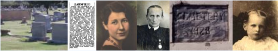
| Pictures and documents—Click the icon to browse through hundreds of historical pictures and document images. | |
| List of last names—click this icon for a list of all last names in your tree | |
| Featured last names—Or click on one of these last names included in the tree: Barnfield, Bonifield, Currie, Davis, Grinstead, Hurley, Matthews, Minton, Moore, Murff, Overby, Smith, Snavely | |

Soldiers
There are many men in this tree who served in the military during the wars of American history. Below, the lineage to veterans that are ancestors to my grandparents is shown:
American Revolution
- Fred Bonifield > Sarah Minton > Celia Woodbury > Mehitabel Pettingill > Amos Pettingill, Private, New Hampshire Militia > Benjamin Pettingill, Captain, New Hampshire Militia
- Fred Bonifield > Sarah Minton > Celia Woodbury > Benjamin Woodbury II > Benjamin Woodbury, Sergeant, New Hampshire, & brother Elisha Woodbury, Captain > Jonathan Woodbury, Private, New Hampshire Militia
- Fred Bonifield > Sarah Minton > Nathan Minton > Jacob Minton > Nancy Johnson > Joseph Johnson, Private, Morris Co. New Jersey Militia & brother Jacob Johnson, light horse cavalry, & brother Gershom Johnson, deputy wagonmaster general
- Carl Barnfield > Emma Hurley > George Hurley > Melissa Yongblood > John Fanning Yongblood > Jeremiah Youngblood > James Youngblood, North Carolina Chatham County Militia
- Katherine Davis > Ollie Overby > Margaret Grinstead > Benjamin Grinstead > Edward Grinstead > John Grinstead II
Others: Isaac Blaidsell, William Cabell, Winthrop Fifield, Levi George
War of 1812
- Carl Barnfield > Emma Hurley > George Hurley > Melissa Yongblood > John Fanning Yongblood > Jeremiah Youngblood
- Carl Barnfield > Emma Hurley > George Hurley > Melissa Yongblood > John Fanning Yongblood > (brother) William Youngblood
- Julia Smith > Wallace Smith > WIlliam Smith > Mary Self > Melchezedec Self
- Fred Bonifield > Sarah Minton > Nathan Minton > Jacob Minton > Nathan Minton
Civil War
- Katherine Davis > Ollie Overby > Margaret Grinstead > Benjamin Grinstead, Virginia Infantry (Confederate)
- Carl Barnfield > Emma Hurley > George Hurley > William Hurley, Texas Calvary (Confederate)
- Julia Smith > Mattie Snavely > John Snavely (Confederate)
Arrivals by Boat
- John Woodbury sailed from Weymouth, England on the Zouch Phoenix, landing in 1624 at Cape Ann, Massachusetts. This expedition was made by the Dorchester Company, the fourth colonizing effort in New England. The Cape Ann settlement failed in 1626, with the settlers moving down the coast to Naumkeag, later renamed Salem.
- William Dodge sailed from England on the Lyon's Whelp, landing in 1629 at Salem, Massachusetts, as part of the Higginson fleet, which was the first expedition to New England's Massachusetts Bay Colony to establish preliminary settlements.
- Tom Davis sailed from Liverpool, England on the Westmoreland, landing in 1854 at Philadelphia, Pennsylvania.
Top 20 surnames
Barnfield (117) Bonifield (36) Bonnifield (9) Davis (37) Freeze (27) Grinstead (205) Irvin (39) Jansen (12) Johnson (32) Minton (53) Moore (27) More (1) Mustard (25) Overbey (5) Overbury (37) Overby (419) Parker (41) Self (36) Skidmore (33) Smith (33) Schnebli (5) Snavely (36) Tobler (26) Vail (35) Veale (1) Veele (1) Vele (5) Willison (23) Woodbury (69)
Top 10 given names
Males
- John (154)
- William (140)
- James (74)
- Thomas (70)
- Robert (69)
- Richard (58)
- George (41)
- Henry (39)
- Samuel (29)
- Edward (25)
Females
- Elizabeth (120)
- Mary (109)
- Sarah (76)
- Ann (62)
- Margaret (43)
- Martha (42)
- Jane (34)
- Anna (26)
- Alice (25)
- Nancy (23)